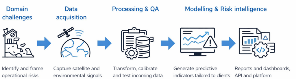
Deltaforms provides predictive risk insight and is developing a scalable platform that transforms space and environmental data into advanced indicators for insurers, infrastructure operators and public actors.
We turn complex physical signals into consistent, explainable outputs that can be used in real decision workflows.
A clear set of applications, built on the same scientific fondations.
Infrastructure and asset risk monitoring
We track deformation signals across critical assets such as bridges, pipelines, roads and industrial sites. Outputs include time series, anomaly detection and indicators designed to support risk monitoring and maintenance prioritisation for both operators and insurers.
Ground instability risk
We are developing predictive indicators for shrink–swell and subsidence exposure affecting housing and local areas. This work requires research, validation and alignment with insurance risk logic, and is currently under development.
Regional risk and resilience analysis
We generate territorial indicators to identify risk-prone zones, understand exposure patterns and support adaptation planning. This capability is designed for portfolio-level risk understanding and long-term resilience strategies.